Not an Arch
April 27, 2026 — Day 34
Lone Rock Beach Campground, Glen Canyon Recreation Area, Big Water, UT
Today we adventure. First up was Biidi The Arch aka the arch behind the Shell Station. This is no longer a hidden gem since anyone who Googles Page finds out about it. Supposedly you park at the Shell station, walk a short distance, and then you are at the Arch.
The actual arch area has a parking lot that holds about 20-30 cars. When we got there it was partially full. The scenery was nice enough but it was nothing special (we say 9 days later). At the time it felt special to us.
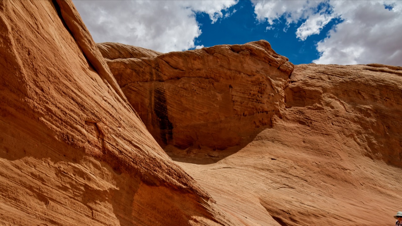
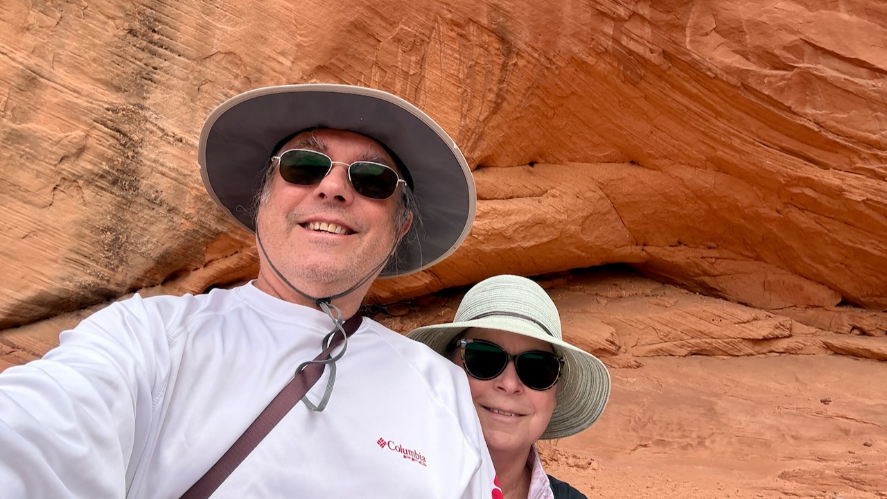
We eventually made it to the arch, except, it wasn’t an arch. It is a very tall concave hollow. If you stand in the exact right spot a Navajo guide will take your photos, with enforced goofy positions, like one leg up or attempting a jump. But it was not an arch! It can best be described as a very shallow shell. The guide yelled, politely at Paul when he took this photo.
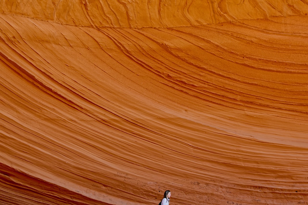
“You have to take the picture of the Arch from here.” We suppose they were just trying to be helpful, but he wasn’t taking pictures of the arch, but rather he was taking a picture of the hollow. Oh well. We were disappointed that our first red thing is Page was a disappointing. Even though it was nice it just didn’t live up to the hype. An arch is an arch? Think McDonald’s golden arches. Google Biidi, you’ll see what we mean.
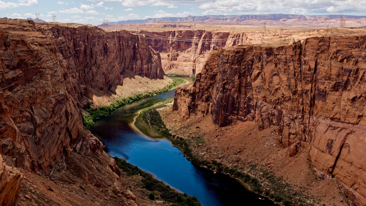
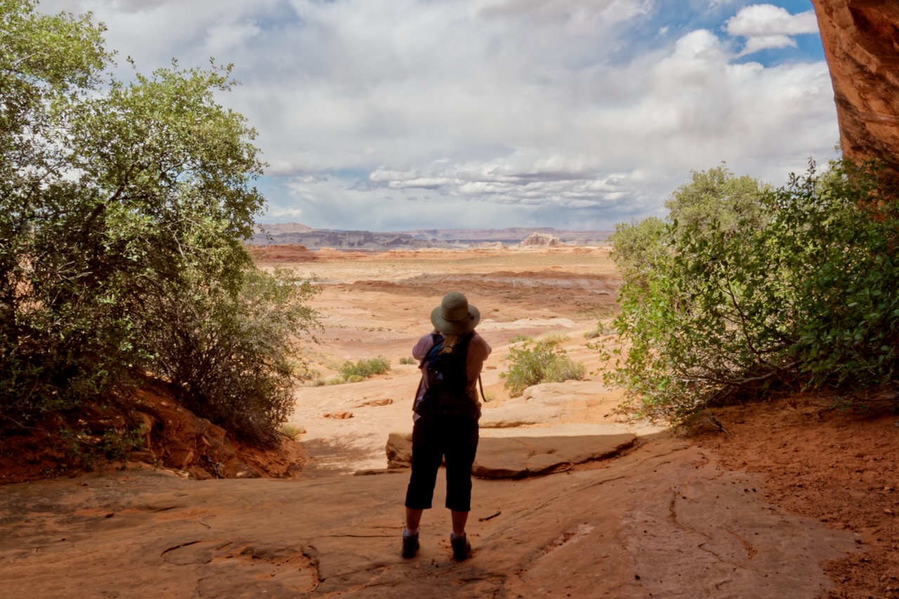
Next up was the Glen Canyon Overlook. The stairs were not stairs they were shelves of sandstone. It was a bit of a slog along uneven surfaces that sometimes leaned one way or the other to get to the platform and a great deal of the time you wanted a FIRM grip on the hand rail which, more often than not, was a bit high to be a hand rail. Some spots had steps. We use that term loosely. Even Susan, who has smallish feet, placed her feet sideways. Not steps so much as a suggestion of a step.
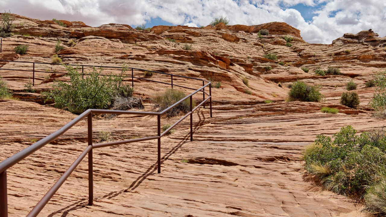
But the view was sure was worth it.
Next up was the Hanging Gardens.
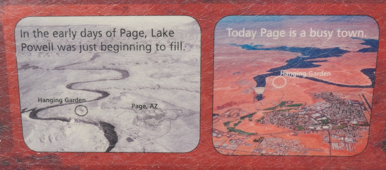
Y’át ééh! Welcome to the Hanging Garden Trail, a short walk to a lush spring in a cool alcove full of maidenhair ferns. Myname is Diana Greymountain, I am Dine’ (Navajo) and Ilive in Page, Arizona. When I first took interest in this trail I was amazed to find out that Page is a very young town, constructed in the 1950s when the U.S. government decided to build the Glen Canyon Bridge and Dam.
In the past, the Ancestral Puebloans used this land to live and thrive. Then they went away and there were no people in the area. Even my grandmothers and grandfathers and their grandmothers and grandfathers did not come to this place. They lived farther away in the canyons, closer to Rainbow Bridge and Navajo Mountain, where it was easy to hide from soldiers and other tribes.
Ahead of you is the base of Manson Mesa. Before 1950 Yazzie Manson controlled all the land around you. He had two sheep corrals up at the top, where Page is now. Hanging Garden was too close to the edge of the canyon to take any livestock; they might fall in. It was good for beauty, but not so good for sheep.
That text is from a trail marker at the start, it also had these historical photos of Page before and after the Dam.
The hike in was easy in spots, but hard in spots with the sand. We were both glad we had wide brimmed hats on and carried water.
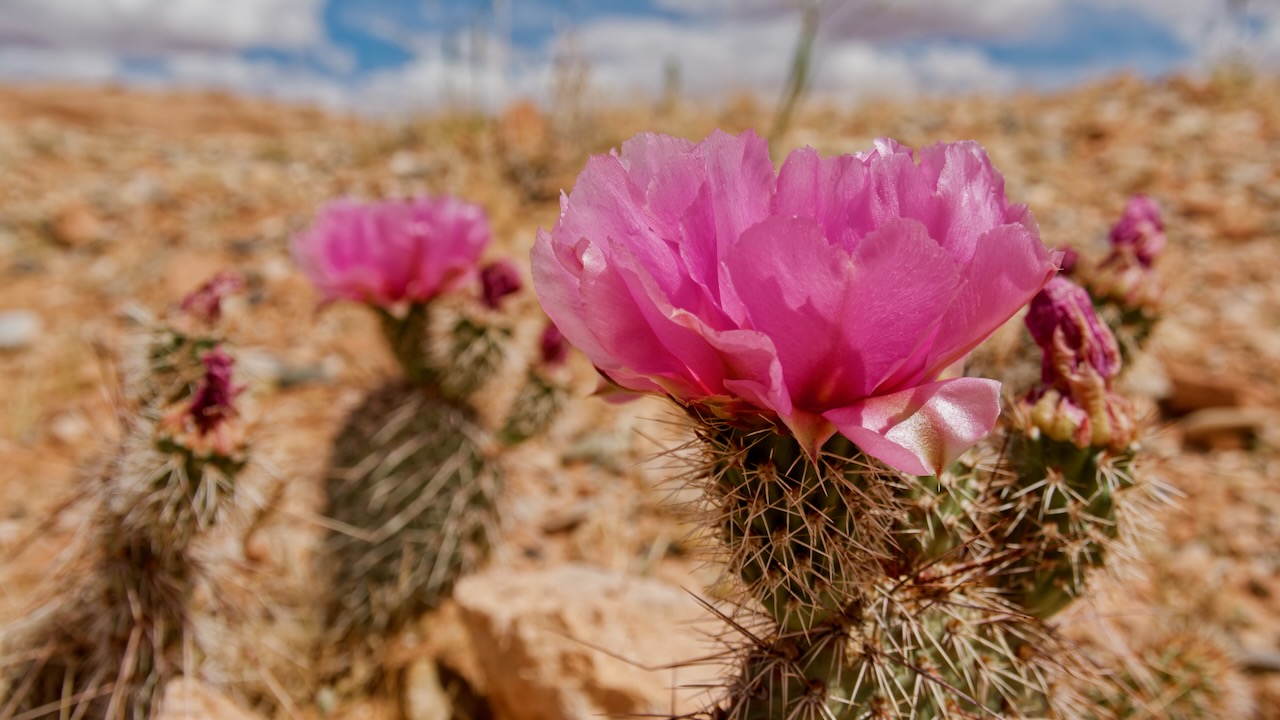
The desert was in full flower mode, color was everywhere. The prickly pear was especially vibrant.
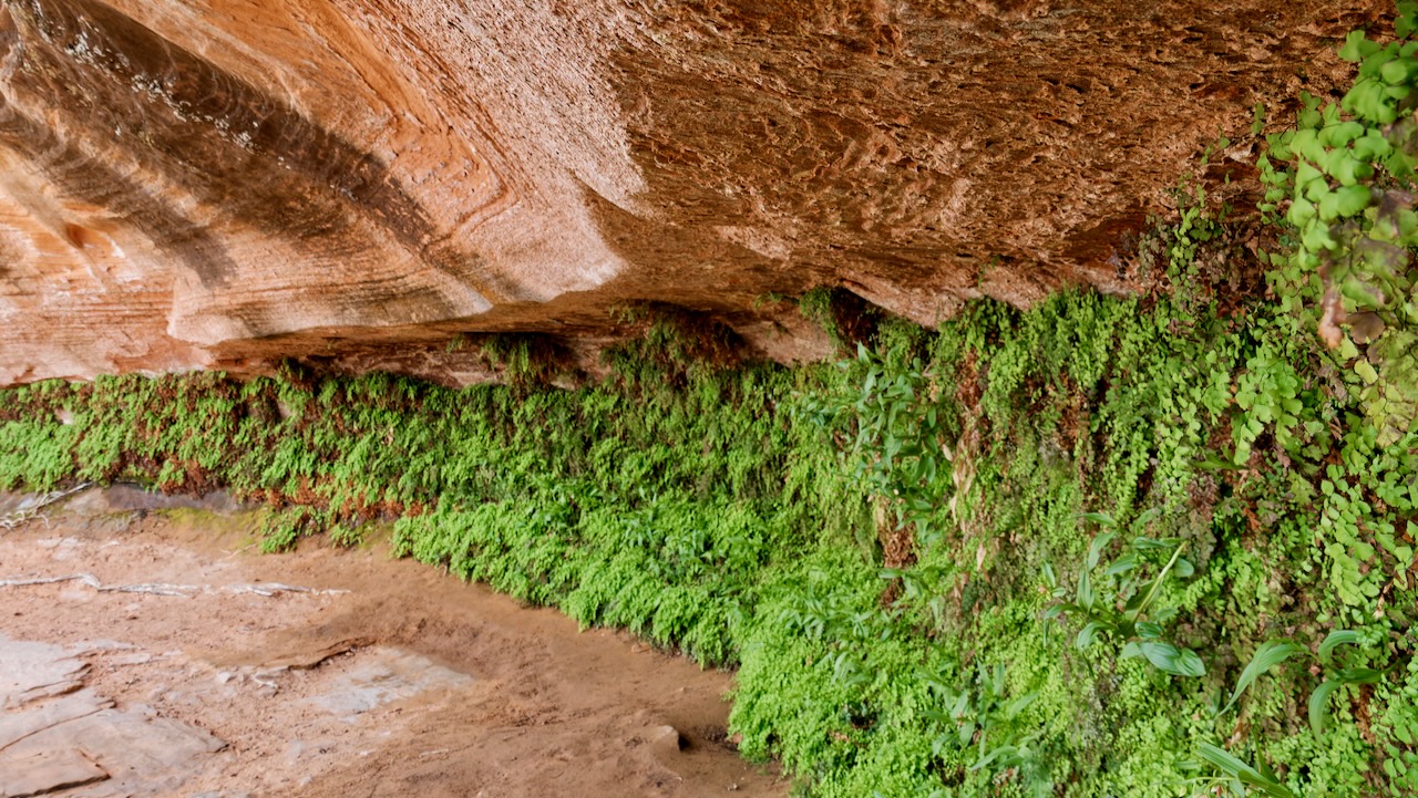
We made it to the hanging garden and were both totally underwhelmed. It did not look at all like the photos. Paul got out his phone and checked the trail, we had made a wrong turn. Soon we were there and it was really worth it.
The trek out was hotter. We ate some oranges at the Jeep before proceeding to The Chains. Susan had read up on these. Paul hadn’t heard of them. We never did find “the chains” although we did see some chains in a few days when we adventured on water.
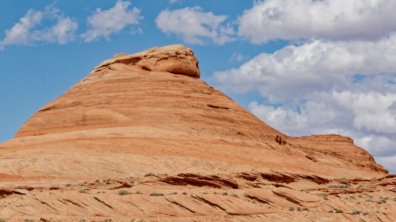
What we did find was Jabba the Hut.
And we had a very good look at the water side of the dam. Paul was exceptionally puzzled. How could the water be so high, the water marks are calcium chloride which stains the red rocks, yet the spillway floor is about 30-50 feet below the high water mark? Huh? We’ll get the answer to that puzzle soon!
On the way back to Lone Rock we drove through the other campground to check it out. There was a giant boat parking lot there! These are much more massive than the photo lets on.
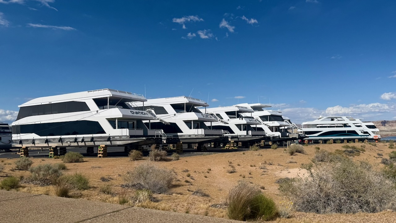
One was either being delivered or removed. It takes a huge truck and some hydraulic jacks and cribs like they do when they raise a house.