Messing About With a Route
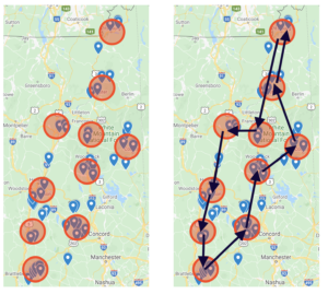
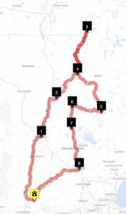
The map from the previous post showed some nice clusters of bridges. I shouldn’t have been surprised, early one I posted an tiny, ancient, map that showed the bridges but the clusters were pretty hard to see. One I had the google maps up though they were easy to see. I’ve circled them on this image and then drew a rough route around them.
This show what the approximate path will likely be. Lets drop those cities in google maps and make a quick and dirty route. Winchester, Concord, Plymouth, Conway, Lancaster, Pittsburg, Lincoln, Bath, Lebanon and Winchester to close the loop.
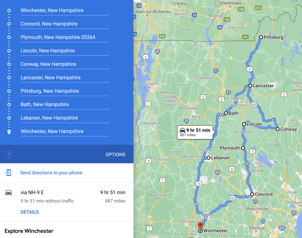
Lets digress a moment though before, why a loop? The Olson maps were loops and I always thought this was great. It meant you could live anywhere and just start the journey and find yourself back home. This is about road tripping, not about moving. And here’s Route 1.
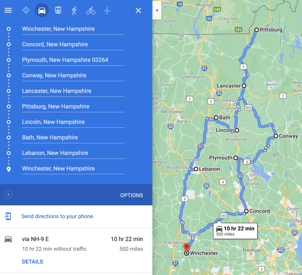
At this point you might be wondering why I’m writing this blog, can’t I just use Google Maps to make the route? No, I can’t for two reason. The first is a practical one, Google Maps only lets you put in 10 waypoints. I need 54. The second is that Google Maps won’t compute an optimal route, you need to guess at it. The good news is that you can easily change things. The middle of the state is complicated. Lets do Conway before Lincoln.
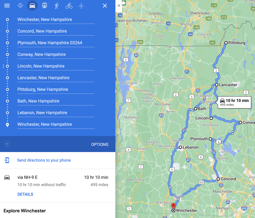
Hey, that saved 5 miles. That’s really not that useful from a road trip perspective, but from a data geek perspective, that’s pretty cool. At this point I realized that the middle of the state is the important part. There are a lot of paths through there since the three clusters aren’t very clustery. Is that a word? It is now. Lets zoom in on the middle of the state.
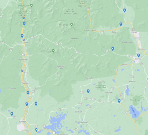
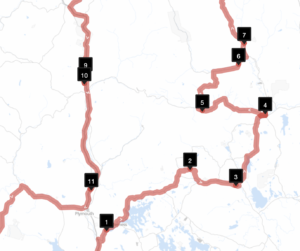
That’s a beautiful part of the state but nasty to navigate. Lincoln to Conway is only 35 miles on the Kancamagus Highway, and incredibly beautiful twisty scenic highway with about a dozen pulls offs and hikes. It should only take an hour but with side trips and leaf peepers, you might be in for a long drive. You also have some seasonal roads, like Bear Notch Road and Sandwich Notch Road. These roads are closed in the winter. From looking at the maps I think Bear Notch Road might come into play. So that means my results, now in winter, may need to be recomputed come Spring.
So how do I create a route through that cluster of three? Lets look at RouteXL.com. This is a free/pay service which computes optimal routes through a set of points. So why again am I writing this blog. It’s because I like the challenge of doing the data, plus I really don’t like their pricing model. You can mess about all day with 20 stops for free. that gives you a great introduction to the tool and it’s perfect for short routes. You can do 100 stop for 5 Euros, but that’s only for one day. A month is 35 Euros. Sorry, that’s too much. (Also, what happens when the service disappears, Rand McNally’s Tripmaker used to do the sam thing but it’s gone now.)
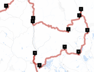
What can we do with 20 free stops? We can make a path through the center of the state!
Interesting, it chose Lincoln then Conway. I wouldn’t have guessed that. This is why we need good information. Let me flip that around in Google Maps.
That trimmed another 8 miles off the route. But now I’m starting to think that the clusters are too coarse. Lets put the exact bridges into RouteXL.
That’s real surprising. This route visits Ashland and then heads east, not visiting the really close by ones in Campton and Plymouth. This didn’t feel right so I added a single additional bridge, in Bath.
So what we see here is that working with partial sets of data gives us extremely misleading results.
Oh, and what’s the distance from above? 526 miles. This is going to be a long trip. You might be thinking that you can do that easy in 2 days, Once if you Cannonball Run it. But that’s not the point. We want to visit the bridges. Let’s say we spend only 15 minutes at a bridge, that’s 13 hours of sightseeing.
This is going to be a long trip.