First Route By Hand
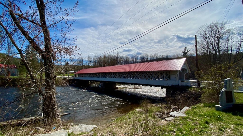
Before diving into computer approaches, I’d thought I’d do it old-school, by hand. Well, as old school as Google Maps is. Google Maps only lets you put in 10 destinations so I’ll break the trip up into section. This works out fairly well since the bridges mostly occur in clusters. I’ll start at Bridge #1, the Ashuelot Bridge in Winchester NH. Why this one? There are many reasons. First, it is number 1, how can I not start there. It is also the southernmost bridge, so it is a good candidate for being correctly placed when we get the real route done. But most importantly, I have a picture of it!
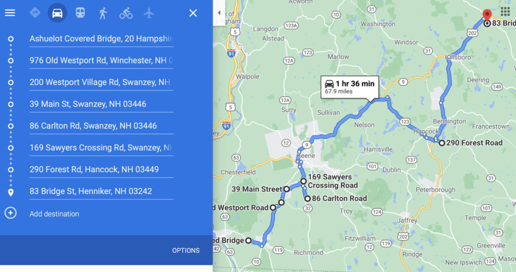
Leg 1 was pretty easy. There was only one real decision, do I do Sawyer’s Crossing or Carlton first. But once I added in County Bridge, in Hopkinton/Greenfield, the path was clear.
Leg 3 require a small amount of fiddling. The area around Plymouth and Campton had a lot of backtracking, which seemed unavoidable. My first attempt was 106 miles. But I was able to shave 4 mile by bypassing the southernly Squam Bridge in Ashland and visiting it on the way out of town.
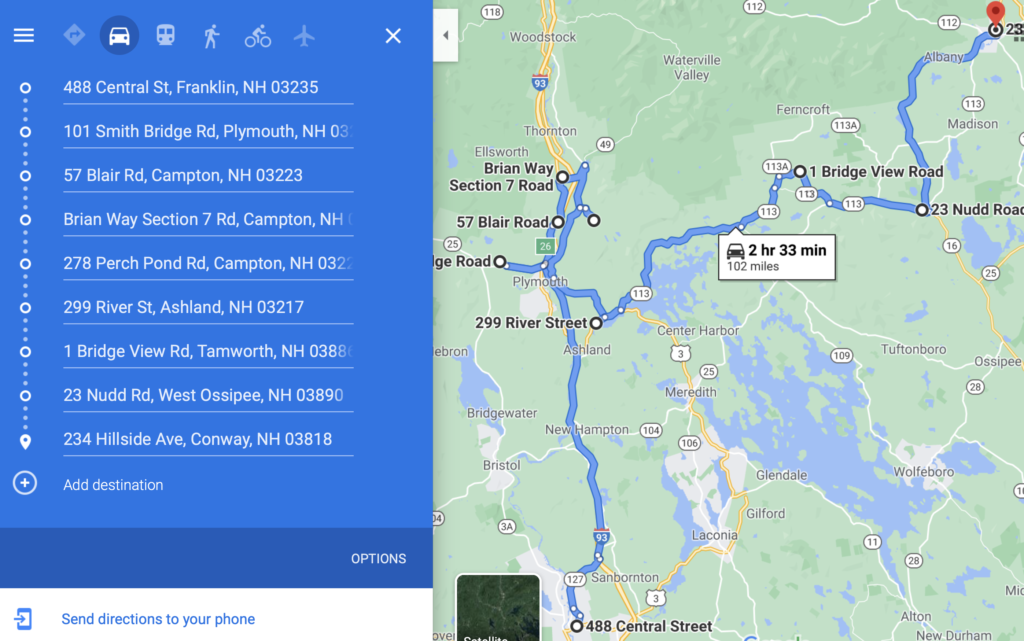
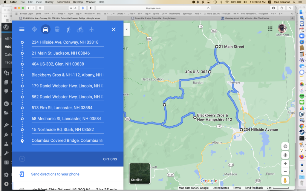
Oh, but wait, in Messing About With a Route we found out that Lincoln should come before Conway, let’s redo it. (And don’t worry, I’m not typing in all those address, I have a Google Map showing the bridges, I’m just cut/pasting the addresses.)
While redoing it, it really seems like those outliers in Tamworth and Osipee really mess things up. You just can’t drive straight to Conway from Lincoln. So I’m going to stay with the Leg 3 I drew above. This is why we need a computational answer.
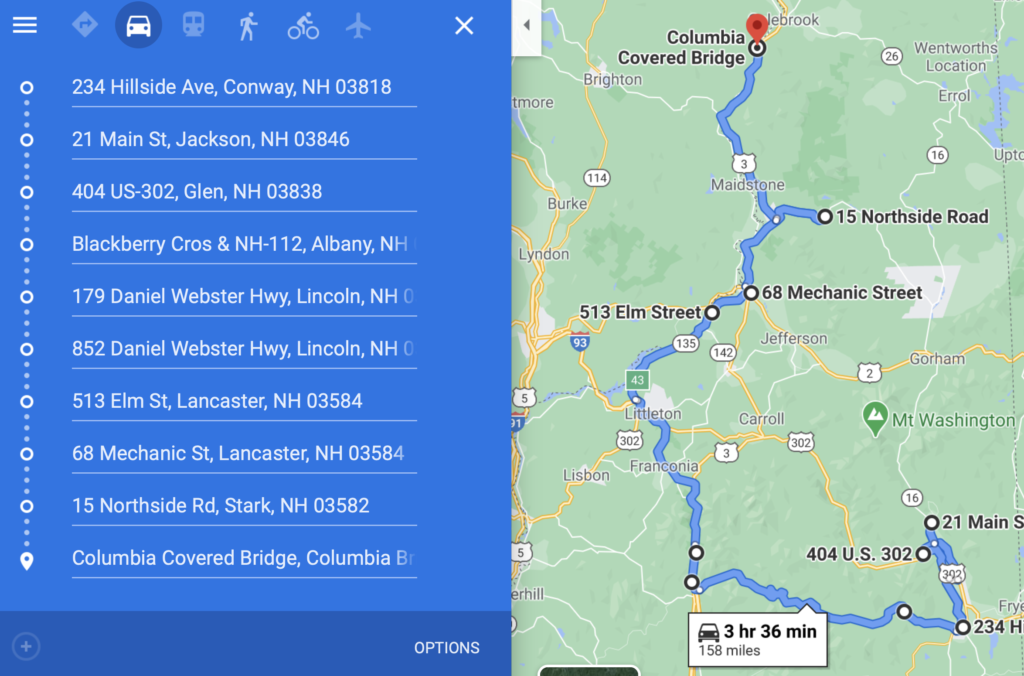
Leg 4 also has a lot of backtracking, I’m not liking it. Odds are pretty good I would also just take Bear Notch Road. It is more scenic and the mileage is the same. I’m guessing Google didn’t take us down it because it is unpaved. It is also closed in winter but it still let me drag a dot to it.
And that’s the last bridge. We just need to add in 32.5 miles to get back to Bridge #1, the Ashuelot Bridge in Winchester NH. (But of course, we’ll not do the loop when driving, we’ll go straight home.) But the loop total is 676 miles.
That’s higher than I expected. I knew the 500 mile coarse route would be much shorter than expected. But I figured 600 miles, maybe 625.
So how long will this take? We have a lot of highway miles, but a lot of back roads. Lets assume an average of 40mph. That’s 17 hours driving. But we need to stop at the bridges. Some have hikes, some are just drive through with parking for a picture, and many let you walk across them. I’ll guess 20 minutes per bridge, that’s 18 hours. (I’m pretty sure I said 15 minutes per bridge earlier, that seems low.) That’s 35 hours for the trip. 7 hours a day is reasonable, that’s 9 to 5 with an hour off for lunch. It means you can sleep in some, get breakfast at the B&B or a diner, lunch at a local place, and then check into the next B&B and ask for a dinner recommendation.
5 days, 4 nights. That’s good to know.